GeezerHiker

July 27, 2010

Divine divides

Filed under: Hiking, North Cascades — Tags: , — geezerwriter @ 9:38 pm

This week for my camping and hiking adventure I chose Skyline Divide and the Damfino area – the access roads for both were just reopened so the Forest Service reports were getting rather stale. I left home about noon on Sunday, set up a camp again at Douglas Fir Campground and headed up Dead Horse Creek Road.

Skyline Divide

Baker over Skyline Divide

Baker over Skyline Divide

The road is in middling condition except for the first mile – someone has spread some very coarse new gravel on the road. This is not soft, crumbly crushed limestone that packs down into smooth surface but big, sharp chunks of some very tough rock – very slow going. About 7 miles in there is a fancy new bridge over Dead Horse Creek (the second place where you cross that creek).

The parking are was full to overflowing, but nothing like last week at Heliotrope.

Heather

Heather

I was only planning to go to point where the trail exits the woods onto the ridge, expecting that there would still be some snow travel, but the trail was entirely clear, except for a few leftover snow puddles. So there I was on the ridge at 4PM, with perfectly clear skies, spectacular views and five more hours of daylight. I could see some good-sized patches of snow along the divide, but nothing that looked dangerous, so I did some figuring and decided that I could hike out toward Mount Baker until about 5:30 and make it back to the car by 7:30 and to camp for dinner at 8:00.

End of the trail

End of the trail

And so it went. I met a good number of hikers, both in the woods and on the ridge, but nothing like the 114 last week. And it was fun meeting them, since they were all grinning from ear to ear! (Did I use “spectacular” already? I need a thesaurus.)

The afternoon light on the mountains was as good as I’d hoped, with the lengthening shadows giving a richness that’s missing at noon.

I ended up  doing almost 8 miles, after intending to do about 5. I was dragging a bit by the time I got back to the car, but no regrets.

As I drove down the long, long 12 miles to the highway, a big bird jumped up from the ground and settled in a tree right along the road. What was left of the sun was right behind him, but I am sure that it was an owl, probably a Barred Owl. This was a first for my life list, as I’d never seen an owl of any kind in the wild before.

When I got back to the tent I decided, for the first time ever, not to put up the rain fly. Often I use it for warmth as much as for rain, but it was such a mild evening that I probably could have just sprawled out on the picnic table.

End of the day

End of the day

Damfino

After a nice night in the tent I made breakfast and packed up the camp. Last week I left the camp set up and got to the trail a half hour sooner, but then had to rush to get back before check-out time. This time I had a long 15 mile drive to and from the trailhead and planned a nice, leisure stroll up to Excelsior Pass and didn’t want to be watching the clock.

Shuksan from High Divide

Shuksan from High Divide

There are three trails starting at the Damfino trailhead at the end of Canyon Creek Road: Excelsior Pass and Peak, Boundary Way and Canyon Ridge. We could do one of these this Thursday before they close the road again on August 2 for another month. I had chosen Canyon Ridge in my mind since it had been reported as free of snow for several weeks, Boundary Way is really short, and Excelsior is really gorgeous in the fall. Since my cover story for these Expotitions is that I am testing the trails for the Trailblazers group, I really should have done Canyon Ridge. But after my almost 8 miles the evening before, I wanted a easy, pretty hike. You can see a good bit of the Canyon Ridge trail right from the trailhead, so I figured I would have a pretty good idea of the snow conditions without walking the trail. And then, at the trailhead, I happened to run into a pair of Forest Service rangers who happened to be headed up the Canyon Ridge trail and said that they would be filing a report at the ranger station in Glacier by Wednesday. So I was off the hook completely and headed for Excelsior.

There are still some pretty big snow islands along the trail, including one that was large enough to make me pause and hunt for the trail, but not enough to amount to a problem. And as I left the woods and approached the pass and High Divide the snow largely disappeared, so this trail is definitely ready for prime time.

After I’d had a snack at the pass it was still only 11:00, so once again my plans had been too modest. I could hike up to the peak, but that’s just another sunny spot with a marvelous view (ho-hum). I had hiked west along the ridge toward Church Mountain, but I had never hiked along the official High Divide trail, which runs to the east along the divide to Welcome Pass. So I picked an arbitrary time and decided to hike east until noon.

Glacier lilies

Glacier lilies

On such a beautiful day, the High Divide trail is a joy. It rambles up and down, but not very steeply, on or just south of the spine of the ridge, occasionally passing through some trees, but mostly with unimpeded glorious views south across the Nooksack Valley to Mount Baker and all his Friends and Relations.

Just before noon I passed a high point just before a deep notch in the ridge exposed a view to the east and decided to stop for lunch. At this point I realized that I hadn’t brought any real food with me, just a few Clif bars. And that my right ankle was beginning to hurt, due to newish boots. So I sat and enjoyed the view and headed back.

In the end my little stroll had turned into nearly 10 miles with 2500′ of elevation gain. It was a little overdone, given the hike the evening before, but I highly recommend it. It is not nearly as tough as Church Mountain and a lot of our other hikes and most of the time is spent in alpine country with great views. And the flowers are coming out!

Bugs are beginning to be in evidence. On both hikes I was pestered by some large insects that I assumed were deer flies, but I never got a good look. Or they could have been bees, which I did see now and then. On the Skyline trail, one fly managed to take a bite out of my shoulder right through my shirt, but that was the only clear episode of carnivorous behavior.

In Summary

It seems that most trails in the North Fork region are now clear of hazardous snow, and from now on we can probably pick any trail that we can get to.

That was a lie. The road to Artist Point is supposed to open on Friday, but since the DOT has been barely able to clear a narrow track in three weeks of concentrated play with their big Tonka trucks, I’m thinking that those trails may still have more than a bit of snow. Aha! I think I know where I’m going next week! With my ice axe.

Baker from High Divide

Baker from High Divide

July 24, 2010

Boulder Ridge in the rain

Filed under: Geology, Hiking, North Cascades — Tags: — geezerwriter @ 6:37 pm

The week before last I spent two days hiking on the east side of Mount Baker with the goal of finding some places where we could hike. The information on the USFS website just didn’t seem very credible so I went to see for myself. In particular they were claiming that there was snow right at Schreiber’s Meadow, the main trailhead in the area, which is at about 3500′ above sea level, while we had been encountering snow only above 4700′ for a couple of weeks.

I left early on Monday, July 12, and planned to go to the Meadow and scout around there, and then do some or all of the Forest Divide, Boulder Ridge, Rainbow Ridge and Park Butte trails over the next two days, based at a camp at the Boulder Creek FS campground. On the previous Friday, the day after a beautiful hike up Goat Mountain in warm, almost too warm, sunny weather, and with the same sort of weather forecast ahead indefinitely, I had made my campground reservation online. About an hour later, the Weather Service began to modify the forecast, and continued doing so throughout the weekend. By Monday it was gloom and drizzle everywhere, but I had already paid for my campsite (and I’m really cheap) so there I was at Schrieber’s Meadow in the rain, with not a single other vehicle parked at the most popular trailhead in the North Cascades.

[Orthographer’s note – I just noticed that I have already spelled the name of that meadow two different ways. It’s a struggle. The name is pronounced like the German word “Schreiber” which means “writer” or “scribe” and is pronounced with an “aye” (as in “Aye, matey!”) but is spelled with an “ie” which has no meaning in German, but would be pronounced as an “ee” (as in “Eek, a snake!”). Usually my rudimentary knowledge of German has helped me in life, but it makes it awfully hard to write “ie” when my mind is saying “aye”.]

The Yellow Aster Complex

Years ago I read in my favorite geology book, “Geology of the North Cascades” by Rowland Tabor and Ralph Taugerud and published by the Mountaineers, of a short off-trail junket to the base of a cliff below Survey Point where there is a rockfall of a complex and very ancient type of local rock called the Yellow Aster Complex, after the place where it was first cataloged near the small lakes at the base of Yellow Aster Butte. Some crystals in the rocks can be dated back over a billion years, into the Pre-Cambrian Era. Igneous rocks were formed then, eroded down into sands and muds, compacted into sedimentary sandstones and shales, then reheated and metamorphosed, perhaps more than once, into something like a gneiss or schist. And over the millennia, it was also cracked and broken, with the cracks being filled in with other sorts of molten rocks. Some books I’ve seen call it a “gneiss” (a coarse-grained metamorphic rock usually derived from granite) but others are non-committal and just call it a “complex” (the geologist’s equivalent of a punt).

The Yellow Aster Complex pops up in a number of places in the area, including the two mentioned above, some spots along the Middle Fork of the Nooksack and near Canyon Creek Road below Church Mountain. But it is often in close proximity with another ancient and even more complex looking mess of a rock called the Bell Pass Melange (another taxonomic punt), so I wanted to get to a spot where I could have it on some authority that the rocks I would find were examples of YAC and not BRM. (We will have the opportunity to see both types in the next week or so on the Yellow Aster Butte trail, if they aren’t all still buried in snow.)

Snow at Schrieber's

Snow at Schrieber's

To get to the rockfall, you go about 2/3 of a mile along the Park Butte trail, then head cross-country toward the cliff and find a ford across Rocky Creek. Almost as soon as I left the trail I was amazed to find patches of snow, corroborating the info on the USFS website! It turns out that there is a lot more snow over there than up along the North Fork of the Nooksack. That makes some sense, since that area is on the leeward slope of Mount Baker for storms that came from the west, and snow does tend to build up on the lee side of a mountain, as it does on the lee side of a fence or a house. The prevailing winds around here in the winter are from the SW, so the Mount Baker Ski Area, which is NE of Baker, normally gets huge amounts of snow despite its modest altitude of 3500′ to 5000′. (I’ve read that more snow falls there than on the top of Baker at 10,800′.) I just saw that the DOT is not even willing to estimate when the road through the ski area to Artist Point will be opened; after almost three weeks of plowing, they are just past halfway up the road.

So that was the major upshot of my trip: there is no point in looking to either Artist Point or the Baker Lake area for trekking opportunities in the next few weeks unless we want to hike with ice axes and crampons. I did manage to do parts of all the hikes I mentioned (except Forest Divide) and I ran into significant snow at 4000 to 4200 feet on all of them.

Boulder Ridge

I will spare you some of the gruesome details, but between the drizzle and nearly falling into rocky Creek (twice), I was wet all over and through for the next two days. Actually it just seemed that way, since down at my campsite at Boulder Creek it only rained a little and just at night.

The only hike where I went a respectable distance was on Boulder Ridge, mainly because its trailhead is at a lower elevation of about 2700′. I wanted to do a good job of checking this one out since it is on our schedule for the first week in September. Pat and Ron hiked it last year and reported that it was a great, if somewhat difficult, hike. Ron says it was one of the most beautiful places he’s ever been, which is saying something around here.

We’ll have to take Ron’s word for the beauty, though, since I couldn’t see anything most of the time. The trees were nice, but how beautiful can a tree be? But on the road and at the trailhead, there were big openings in the trees, which I could imagine being filled with some great views of the mountains east of Baker Lake (Blum, Hagen, Bacon, et al.), and I read somewhere online that the trailhead is one of the most beautiful in the area.

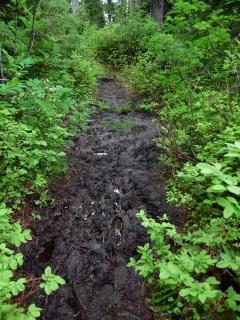
Mudhole #1

Mudhole #1

The trail heads immediately into the woods and is quite gentle for the first two miles, rising only about 500′. There were a lot of muddy spots, and I found myself wishing that the trail would get steeper and allow the water to run off. And it did get steeper. About the time I was regretting what I’d wished for it leveled out again and presented some truly epic mudholes that dwarfed the earlier ones, and then came out into a lovely open meadow – I could almost see Maria and the Lonely Goatherd gamboling through.

The Meadow

The Meadow

But it was, in fact, a bog. There was water running everywhere just below the level of the grasses. It turned out to be possible to pick my way across without immersing my boots, but I had to choose carefully.

And just past the bog the character of the trail changed dramatically – a quick right turn sent me straight up the side of the ridge without benefit of switchbacks. It is as steep as anything I’ve ever encountered that is still called a trail – it comes close to being a scramble. There are plenty of trees and other flora to grab for support, so it wasn’t at all scary, except for one big rounded outcrop of old Chilliwack River volcanic rock. It was glistening wet from the drizzle and exposed to a dramatic drop-off to Boulder Creek a long way below, but turned out not to be slippery and to have many small pits and cracks where a boot could get a good purchase. Combined with the wetness, both the very light drizzle in the air and the wet foliage alongside the narrow “trail”, it was a pretty miserable slog, and I was one soggy and dirty dude.

Chilliwack volcanics

Chilliwack volcanics

The Bog (same as The Meadow)

The Bog (same as The Meadow)

But it really didn’t go on for that long. It was only about a half a mile before slope eased up and the trail starts to come out of the trees onto a bit of a ridge. The geology underfoot also changed quite abruptly to modern Mount Baker lava rock, and the mist pulled back just enough to get some foggy glimpses of the head of the valley. I’m pretty sure that the blank whiteness of cloud ahead above the valley was hiding a truly spectacular view of Mount Baker. (After I got home I checked on my computerized topographic maps that it was only 3 miles to the summit. It would be basically the same view that DJan took from Baker Lake Road on our Baker River hike,  but 4 miles closer).

Looking toward Baker?

Looking toward Baker?

From what I read in various climbers’ reports (this is one of the less popular climbing routes to Mount Baker, but even here I ran into two pairs of climbers who, thankfully, had been on the summit the day before when it was sunny) that there is about another mile of trail beyond the point where I ran into deep snow, for a total of almost 4 miles. At that point there is a cliff that requires some technical work to get up onto the ridge for the Baker ascent.

When I got back to the car at almost 8PM I was wet and as dirty as I’ve ever been on a hike, but I still think it would be worth our while to do it. By September it should be pretty well dried out, and it was the wetness that was the worst part of the hike. The steep section is as tough as anything we regularly do (think about the Oyster Dome trail) but it is only a minor part. And there should be a great scenic payoff if we can hit a nice day, which in early September is a pretty good bet.

July 18, 2010

Gold Run Pass

Filed under: Hiking, North Cascades — Tags: — geezerwriter @ 9:05 pm

As I mentioned in my posting about Heliotrope Ridge, I was shut out from my plan to explore Skyline Divide for snow conditions by the closure of Dead Horse Creek Road for maintenance. I considered just packing up and going home but the tent was already set up at Douglas Fir Campground, it was nearing 8PM and I didn’t much feel like a 40 mile drive. As I puttered around that evening, I considered Excelsior Pass and Hannegan Pass, but in the end decided to try the Yellow Aster Butte trail, which we were scheduled to do last week. It is a moderate trail that is prettier than the others, and I decided to just do the first part of the trail: the old Tomyhoi Lake trail passes the turnoff to Yellow Aster Butte and climbs to a gorgeous overlook at Gold Run Pass and then down to Tomyhoi Lake. From that trail junction one can see across the valley to the next mile or so of the YAB trail and from the pass see out to Low Pass and the Border Peaks, so there was a lot of potential information to be gotten from 2 mile hike.

After a leisurely breakfast at the campsite, I hit the trail before 8:00AM, giving a big head start compared to our group hikes. We meet in Bellingham at 8:00, but after we repack our cars, stop for a bathroom break at the Glacier ranger station and drive 50 miles, it is close to 10:00 before we start hiking. I planned to go Gold Run Pass and get back by noon, in time to drive back to Glacier and pack up my camp before the 1:00PM checkout time.

Baker from Swamp Creek Valley

Baker from Swamp Creek Valley

The trail is in great condition, with some new(?) steps to help you up the steep slope at the trailhead and other evidence of trail reconstruction further on. The views of Mount Baker from the clearcut near the trailhead, were even better than usual, since the sun was lower. There was no sign of snow for about a mile and a quarter (4700′ elevation) and then just occasional patches. As the trail levels out and enters the meadows, the snow becomes solid, and the trail disappears for awhile. There was a fairly clear boot track, but I didn’t trust it, and I hadn’t put an old track into my GPS, since I hadn’t planned to do this hike. I’d been up there in the winter several years ago and it is tempting to drift to the left out into the center of the valley, where you can see the pass up ahead. But if you do that you will end up at the base of a slope that, while not exactly a cliff, is almost impossibly steep despite its benign appearance from a distance. This valley was probably a cirque for a small valley glacier in colder times, and they typically have rounded bottoms but nearly vertical sides.

So I forced myself to stay to the right, where I knew that the trail enters the woods and travels up along the valley wall. I came to a clear spot in the snow that sort of looked like it could be part of the trail (which takes a number of twists and turns in this muddy meadow) but there was a small tree down and a big mud hole. I went around those and kept over to my right and kept looking for the spot where the trail enters the woods, but eventually gave up looking and assumed that I’d missed the trail. I came across a small creek that seemed to be coming from a good direction and followed it as it quickly dried up; the creek bed was pointing straight up the slope toward the trail, and was full of big rocks that made a good flight of stairs, and shortly reached the trail again.

Yellow Aster trail

Yellow Aster trail

At this point I was only about 100 yards from the Yellow Aster junction and could see across the valley to where the trail was crossing some fairly large snow patches. About a mile away there was a lot of solid snow in and beyond that little rift valley that always holds the snow into the fall, and I could see a track in the snow leading up out of the valley. The sign-in sheet back at the trailhead indicated that some people had been making it all the way to the Butte, which I could easily believe. After another week or two of melting it will be ready for us.

Larrabee and the Border Peaks

Larrabee and the Border Peaks

Baker from Gold Run

Baker from Gold Run

There was no more snow on the trail up to the pass, and the view of Mount Larrabee and the Border Peaks was as stunning as ever. This is one of the few places around here where there is a clear view of Mount Baker, but just about everyone sits with their backs turned to it.

Looking toward Low Pass

Looking toward Low Pass

There was a good view of the Low Pass area – it looks like there is a lot of snow over there. So the trip to High Pass scheduled for this Thursday is a bad idea.

There was no problem following the trail on the way back. And that spot with the fallen tree was indeed right on the trail. If I’d turned even harder to the right at that point I would have stayed on the trail the whole way. So the route-finding would not be a problem if I were to go again, and another week’s melting should move this hike into prime time.

Can’t resist putting in one more picture of one of my favorite places on earth – the Border Peaks.

The Border Peaks

Canadian and American Border Peaks

July 12, 2010

Heliotrope Ridge

Filed under: Geology, Hiking, North Cascades — Tags: — geezerwriter @ 1:35 pm

On Sunday, July 18, I drove out to Douglas Fir Forest Service campground near Glacier, set up my camp at 2:00 in the afternoon and headed right out to hike. My plan to explore the Skyline Divide trail for snow conditions was thwarted when I turned onto Dead Horse Creek Road (FS #37) and was greeted by an orange sign announcing the closure of the road at mile 7.1, a good 5 miles short of the trailhead. So I switched to Plan B and headed on up Glacier Creek Road (FS #39) to Heliotrope Ridge, which I had been planning to do the next morning. I would then have all evening to decide where, if anywhere, to go the next day.

Uphill from the outhouse

Uphill from the outhouse

The road is in good shape, but I went slowly, figuring that I would be going against any traffic on this beautiful Sunday afternoon, on the way to one of the most popular day hikes in the area and the start of the most popular climbing route to Mount Baker. I didn’t meet many cars on the road, but well before I could see the parking lot, there were parked cars packed along the side of the road. The first place I found to park was at the upper end of the parking area, right next to the outhouse, and the chain of parked cars continued on up the hill and out of sight around the next curve.

New bridge over Grouse Creek

New bridge over Grouse Creek

It was hard to believe that there was room for people from all those cars to fit on the trail, and even before crossing the brand new bridge across Grouse Creek (remember the flattened log with a steel cable handrail?) I began to meet people, both climbers with great huge packs and day hikers in tennies and their dogs. I decided to count them: in a little over an hour, I met 123 critturs of the human and canine persuasions, for a total of 264 feet/paws tromping on the trail. [Assuming that all individuals had the usual number of legs, how many were people and how many were dogs? Show your work.] Most hikers were coming down, but early in the hike I was passed by a couple of teenaged boys with skimpy packs and a black dog.

The trail is in great shape, despite the usual downed tree or two, and there was no snow at all until almost 5000′ elevation – a bit surprising since the trail is sheltered from the sun on the north side of the ridge. On the other hand, this is the windward side of Baker, which normally gets less snow. Just last week on the opposite side of the mountain on Boulder Ridge there was substantial snow cover at 4000′.

And the creek crossings are good, too. The Kulshan Creek ford, the first one that looks scary (but never stops us), has a lot of water, but many well-placed stepping stones. The big Heliotrope Creek crossing, the only one that has turned us back in recent years, has a big, sturdy snow bridge just above the trail. But I had found a nice spot to cross before I saw the trail “trodden black” across the snow bridge.

First look at Baker

First look at Baker

As I reached Heliotrope Creek, I met a family group of 4 who had just passed me, but had turned around after deciding not to cross the creek. The father (I presume) asked me to watch out for the two boys with the black dog, as they had become separated. (Well separated, indeed, as the boys had passed me an hour earlier.) They were guessing that the boys had turned off on the climbing route, about a quarter mile back, and were going to go back and try that route. None of us were expecting me to see them, since there wasn’t much trail left in the direction I was going, and they had passed me a long time ago.

Up the Coleman Glacier to Baker

Up the Coleman Glacier to Baker

I got over to the the moraine overlooking Coleman Glacier and headed up toward Baker. We have been doing this hike in the late fall in recent years and have only made it up to the point where the tree-covered moraine runs into a ridge of solid volcanic rock that (I believe) is called the Hogback. On this day I got quite a bit further up, since it was essentially free of snow.

I was looking up at the high point of the rocky ridge that I had chosen as my destination when I saw the black dog, and then the two boys. Oops. I hoped that they were not going any further and that I could catch up to them, but I was right at the base of a steep rocky hill which would slow me down. And then I saw the older boy seeming to move further on. So I waved and just bellowed as loud as I could, and managed to get the younger’s attention. They came back down to meet me and I filled them in on the situation, told them to go back to the climbing route junction and made them promise that at least one of them would stay there until they found their family. Good deed for today? – check!

Threatening clouds?

Threatening clouds?

The views were absolutely splendid, better than usual because of the time of day. It was after 5:00PM, and shadows were beginning to deepen on the glaciers but the sun was still bright. To the south and west some puffy cumulus clouds were trying to grow into thunderheads and scare every one off the mountain, but they weren’t very convincing. Besides, almost everyone was already gone.

My dinner spot on the Hogback

My dinner spot on the Hogback

I spent about a half hour having dinner there on the Hogback and taking many, many pictures. The trip down was uneventful and not nearly as busy – I only saw 5 more people.

So the Senior Trailblazers have a hike for this Thursday, after all. The lovely weather is supposed to continue indefinitely and I look forward to a fine outing, perhaps even as great as last week’s trip to the top of Church Mountain. But that’s asking a lot.

Baker over the Hogback

Baker over the Hogback


July 7, 2010

Mountains, beer and pizza – What’s not to like?

Filed under: Geology, Hiking, North Cascades — Tags: , — geezerwriter @ 9:25 pm
The North Fork

The North Fork

On Tuesday, Karen, DJan and I set off for an afternoon hike in the North Cascades. The main reason for trying this radical variation from our usual early morning departure was to take advantage of the sudden appearance of summer after our June of Gloom and to take pictures in the afternoon light. We are usually up in the high country at the very worst time of day, with the sun directly overhead (or what passes for that here on the 49th parallel) or shining right in our eyes; by the time the light softens and the shadows begin to lengthen we are back at the trailhead or on our way back to town.

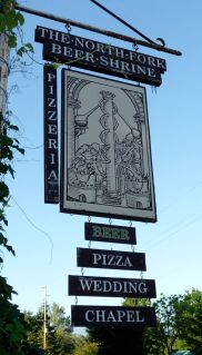
The immediate impetus for this trip was the partial closure of Canyon Creek Road for the next two months for repaving. On weekdays (M-Th) it is supposed to be closed from 8-5:00 except at lunchtime – our idea was to get up to the base of the road at noon, scoot up to the Damfino Lakes trailhead, hike and enjoy the afternoon light and come back down after 5:00, stopping for dinner at the celebrated North Fork Beer Shrine, Pizzeria and Wedding Chapel on Mount Baker Highway near Kendall.

We all found it a bit disorienting to be leaving for a hike in the middle of the day – we were all double- and triple-checking our gear. But everything was going along fine until I made the mistake of stopping at the Glacier Public Service Center (nee Ranger Station) and asking someone (who actually seemed to know what she was talking about) for an update on the Canyon Creek situation. She was very discouraging: the contractor is “supposed to” open the road from 12-1:00, but they don’t have much direct control over them; it will open again “around 5:00 or maybe later”; there were fresh reports of patchy snow near the lakes (only a half mile into the hike) and solid snow from there to Excelsior Pass. She urged us to give the warm weather at least a week to melt the trail out, and suggested Goat Mountain, where you can get above tree line without snow, as an alternative.

So there we were, all dressed up and no place to go. Goat Mountain did sound like a good choice, even though we just did it a month ago, but it seemed like a better choice for the main group hike on Thursday.

For some reason that I no longer remember, that morning I had read the FS website report on Wells Creek Road: the gate that closes the road to protect elk habitat during the winter just the past Nooksack Falls viewing area had just been opened on July 1, but the road was said to be partially blocked at mile 10.3. If we could drive to that point, a bit over 2 miles from the trailhead, we could perhaps hike up the road and then start up the trail and reach a really nice viewpoint that comes about a half mile up the trail. And the drive up that road, while long (12.5 miles) and difficult, affords some of the best mountain views, especially of Mount Baker, that you can find from any road in the area, with the possible exception of Artist Point at the end of Mount Baker Highway. So even if we couldn’t get a decent hike, there would be a good scenic payoff.

Mount Baker between Ptarmigan & Chowder Ridges

Baker between Ptarmigan & Chowder Ridges

So off we went. And everything I’d remembered about the trip up that road came true in spades. The first four miles is in pretty good shape and gives some great views up the Bar Creek valley to Baker. At that point the road begins to climb rapidly and deteriorates at a similar rate. (The picture at the left was taken from the side of the road about 8 miles in.) Decent stretches of road alternate with some truly dreadful patches. And “patches” is a bit too kind – some are long enough that you begin to forget what normal driving is like. And there are a couple of traverses of rocky faces that are truly scary – maybe not quite as bad as the upper section of Twin Lakes Road, but they are in the same ball park.

I had neither the time nor the inclination to study up close the rocks that were obviously resentful of our presence, but they looked to be volcanic, similar to stuff we see along Ptarmigan Ridge near Mount Baker and different from the mostly sedimentary bedrock along the North Fork of the Nooksack River. (Chowder Ridge, for example, was named for the fossil shellfish found there.) So these would seem to be part of what is called, appropriately enough, the Wells Creek Volcanic Formation, remnants of one of an ancient of volcanic ancestor of Mount Baker,

It was on the worst of these traverses that we passed what we believed to be the advertised “partial” closure – a couple of small boulders 15″-18″ across that were nestled against the uphill side of the already very narrow roadway. I drove as close as I could to the boulders, reasoning that a scrape on the side of the car would be a lot better than the available alternative.

Just a short way further on, at about 4400′ of altitude, we came to patch of snow that had a set of tracks through it, but still looked a little dicey. So we parked and headed up the road – we were now about 1.5 miles from the trailhead, at 4900′ the highest drivable spot in the area except Artist Point (I’m not counting Twin Lakes as drivable). We soon passed a parked car that had made it through the snow patch that had stopped me, and we could see the tracks of two people and a dog.  The hiking was fine for about a mile, with a lot of dry road and occasional snow patches, but suddenly at a fork in the road at about 4700′ the road was solid snow. The road also got steeper at that point. There was very little snow off the road in the woods, and my hope was that when we got to the trail proper the tree cover would give us some bare ground, and we could still make it to the viewpoint. (If not, we couldn’t be too broken-hearted, for there were nice views of Shuksan along the road. But still.)

Baker

Baker

My stalwart companions were game to continue and we completed the slog to the parking lot none the worse for wear. The ground was completely snow-covered, but not very deeply; the parking area is ringed by some big boulders, about 3 feet across, and these were standing well proud of the snow. But there was no sign of a trail, and I couldn’t remember exactly where it runs. From this point the trail goes right up the ridge, so there’s very little possibility of getting lost – you just head uphill as steeply as you can manage.

Well, we never found the trail but a mild case of summit fever drove us on up the ridge until a stunning view of Baker suddenly jumped out in front of us. This was the place I remembered, but I had forgotten how stunning the views are: 360 degrees of spectacular North Cascades scenery, Mount Shuksan, Church Mountain, Larrabee, Tomyhoi, etc., etc., and so forth.

Shuksan

Shuksan

I did my best to get us lost on the way down – it is harder to go down a ridge in the snow, since gravity wants to pull you off the ridgeline, but we did make it back to the trailhead and on down the road. The limit of the solid snow was right where we’d found it on the way up, but from there on it was hard to believe the amount of melting that had gone on in just a few hours. We all remembered crossing a good number of snow patches, but the road was clear and even dry now, except for those first patches that had stopped the car. And those were seriously depleted.

We have noticed on our recent hikes that we will be going along with no snow visible and all of a sudden we are in deep stuff. During our rainy May and early June (almost 6″ of rainfall in Bellingham) the snow level must have sat at about 5000′ and just dumped a huge amount of snow. We reached an altitude of 5400′ yesterday, and the snow was still not much deeper than it had been at 4700′. I’m taking this as a good omen: Now that we are having some sunshine and genuinely warm weather (life-long residents call it “hot”) I’m betting that the snow is going to disappear in a flash. (I will of course deny that I ever said any such thing when we are still scrambling to find hikable trails in August.)

Baker from Wells Creek road

Baker from Wells Creek road

The North Fork Beer Shrine lived up to its advance billing: we tried 3 of their homemade beers and shared a large Greek pizza. The pizza was truly excellent, and not just because we were ravenous. (I just finished the leftovers an hour ago, and it was even good cold.) The beers got mixed reviews: the India Pale Ale was the unanimous favorite.

Create a free website or blog at WordPress.com.